
Related Images


Download:
| Tiny | 166x128 | View | Download |
| Small | 333x256 | View | Download |
| Medium | 667x512 | View | Download |
| Large | 1334x1024 | View | Download |
| Original | 4395x3372 | View | Download |
This image was acquired from
wikimedia. It was marked as Public Domain or CC0 and is free to use. To verify, go to the source and check the information there.
Looking for more info about this image?
Try a Google Reverse Image Search for it.
Try a Google Reverse Image Search for it.
Keywords from Image Description:
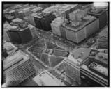
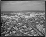
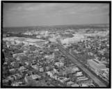
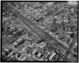
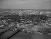
thstreetbridges . en Aerial view of the southeast quadrant of Washington looking northwest from above the Anacostia River The th Street Bridges can be seen in the lower left corner of the image Southeast Freeway runs diagonally through the center of the image The two buildings of the Anacostia Community Boathouse can be seen between