
Related Images


Download:
| Tiny | 170x128 | View | Download |
| Small | 341x256 | View | Download |
| Medium | 682x512 | View | Download |
| Original png | 997x748 | View | Download |
| Original as jpg | 997x748 | View | Download |
This image was acquired from
wikimedia. It was marked as Public Domain or CC0 and is free to use. To verify, go to the source and check the information there.
Looking for more info about this image?
Try a Google Reverse Image Search for it.
Try a Google Reverse Image Search for it.
Keywords from Image Description:
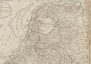
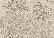
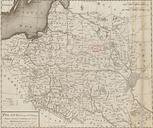
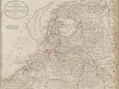
Rotterdam detail of map United Provinces of Holland by Carey BPL . Detail of The seven United provinces of Holland Groningen Gelders Friesland Overyssel Utrecht and Zealand from the best authorities Author Carey Mathew Publisher Carey Mathew Date Dimension cm Boston Public Library Map Center bpl org Mathew Carey PDold Old