
Related Images


Download:
| Tiny | 155x128 | View | Download |
| Small | 310x256 | View | Download |
| Medium | 621x512 | View | Download |
| Large | 1243x1024 | View | Download |
| Original | 8485x6990 | View | Download |
This image was acquired from
wikimedia. It was marked as Public Domain or CC0 and is free to use. To verify, go to the source and check the information there.
Looking for more info about this image?
Try a Google Reverse Image Search for it.
Try a Google Reverse Image Search for it.
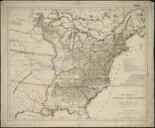
Keywords from Image Description:
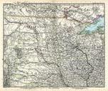
Reichard Vereinigte Staaten von NordAmerica. LargeImage en Map of the United States of North America possibly the first published map with Albers equalarea projection cm bpl org Normal Leventhal Map Center Boston Public Library Call Number Christian Gottlieb Reichard cartographer Trummer engraver PDold Maps of the United