Related Images


Download:
| Tiny | 77x128 | View | Download |
| Small | 154x256 | View | Download |
| Medium | 309x512 | View | Download |
| Large | 618x1024 | View | Download |
| Original | 3536x5856 | View | Download |
This image was acquired from
wikimedia. It was marked as Public Domain or CC0 and is free to use. To verify, go to the source and check the information there.
Looking for more info about this image?
Try a Google Reverse Image Search for it.
Try a Google Reverse Image Search for it.
Keywords from Image Description:
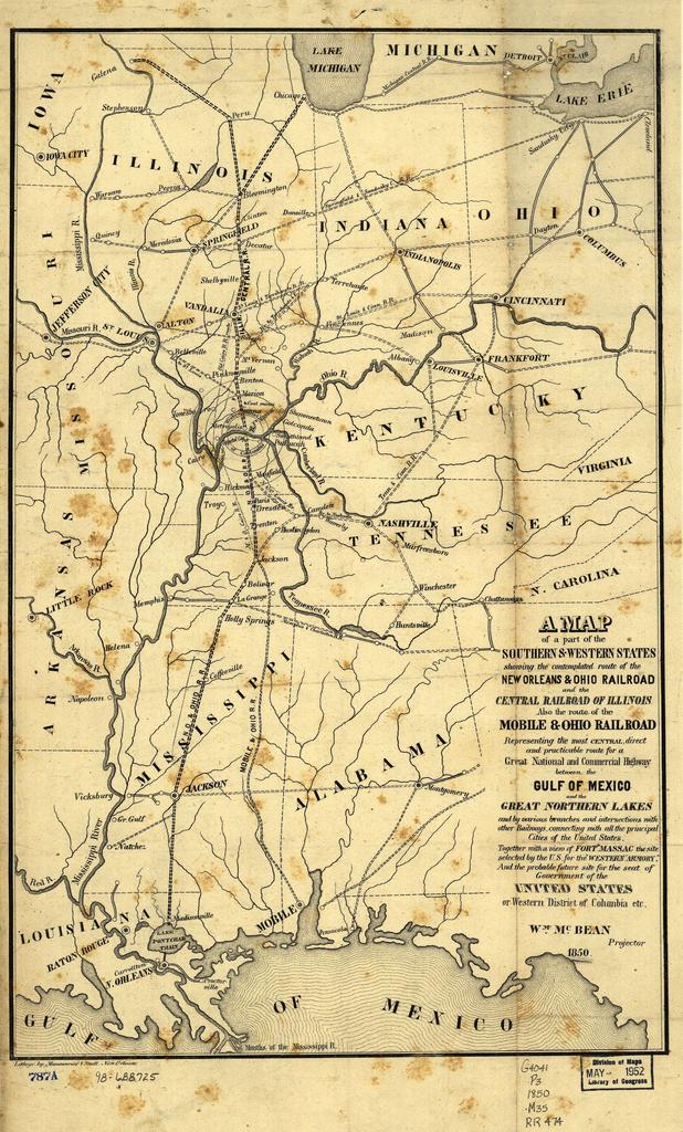
IC. map of the Illinois Central Railroad and New Orleans and Ohio Railroad which became part of the IC from loc gov ammem field NUMBER band gprr Also shows the Mobile and Ohio Railroad later part of the Gulf Mobile and Ohio Railroad Also shows the proposed Western District of Columbia where the two lines would meet including Metropolis