
Related Images
Download:
| Tiny | 181x128 | View | Download |
| Small | 362x256 | View | Download |
| Medium | 724x512 | View | Download |
| Large | 1448x1024 | View | Download |
| Original | 4000x2828 | View | Download |
This image was acquired from
wikimedia. It was marked as Public Domain or CC0 and is free to use. To verify, go to the source and check the information there.
Looking for more info about this image?
Try a Google Reverse Image Search for it.
Try a Google Reverse Image Search for it.
Keywords from Image Description:
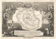
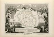
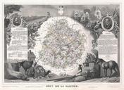
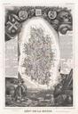
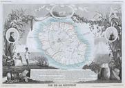
Levasseur Map of Ile de La Reunion Geographicus Reunionlevasseur. This is fascinating map of the French island colony of Reunion in the Indian Ocean off the coast of Madagascar Depicts the island in moderate detail with both political and geographical indications The whole is surrounded by elaborate decorative engravings designed