
Related Images


Download:
| Tiny | 107x128 | View | Download |
| Small | 215x256 | View | Download |
| Medium | 430x512 | View | Download |
| Large | 860x1024 | View | Download |
| Original | 3046x3624 | View | Download |
This image was acquired from
wikimedia. It was marked as Public Domain or CC0 and is free to use. To verify, go to the source and check the information there.
Looking for more info about this image?
Try a Google Reverse Image Search for it.
Try a Google Reverse Image Search for it.
Keywords from Image Description:
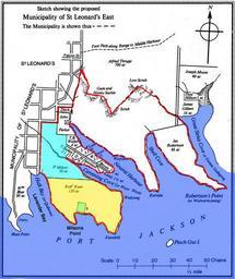
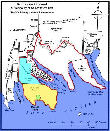
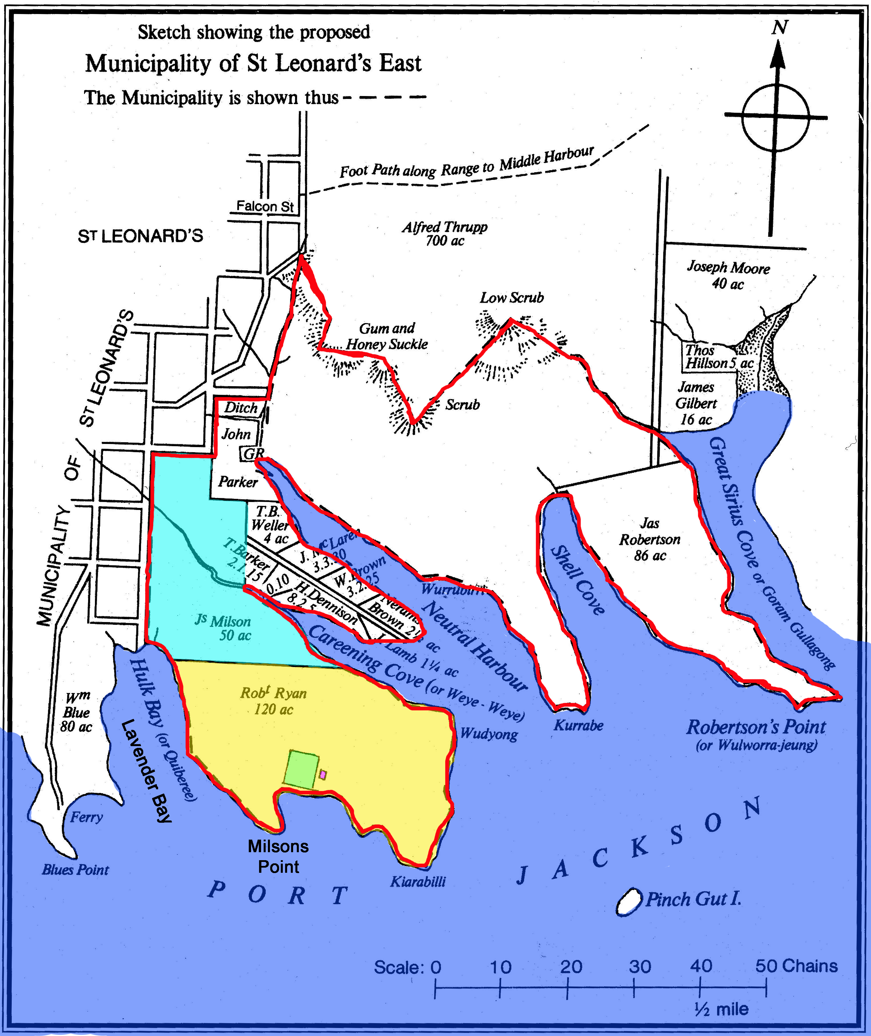
s map of proposed Municipality of East St Leonards. Map is from but refers to earlier land grants Caption reads Early map published in the North Shore Times May showing the boundary of the Municipality of St Leonards East proclaimed Added to the original map are the words Lavender Bay which used to be called Hulk Bay and Milsons