
Related Images


Download:
| Tiny | 120x128 | View | Download |
| Small | 240x256 | View | Download |
| Medium | 481x512 | View | Download |
| Large | 963x1024 | View | Download |
| Original | 12494x13272 | View | Download |
This image was acquired from
wikimedia. It was marked as Public Domain or CC0 and is free to use. To verify, go to the source and check the information there.
Looking for more info about this image?
Try a Google Reverse Image Search for it.
Try a Google Reverse Image Search for it.
Keywords from Image Description:
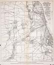
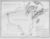
Rees map of Chicagoland. Map Rees James Ferd Mayer Co Institution Library of Congress PDold map date Chicago warp status Chicago Ill James Rees print date accession number cm other versions loc gov maps Old maps of Chicago Chicago in the s