
Related Images

Download:
| Tiny | 106x128 | View | Download |
| Small | 212x256 | View | Download |
| Medium | 424x512 | View | Download |
| Large | 848x1024 | View | Download |
| Original | 3314x4000 | View | Download |
This image was acquired from
wikimedia. It was marked as Public Domain or CC0 and is free to use. To verify, go to the source and check the information there.
Looking for more info about this image?
Try a Google Reverse Image Search for it.
Try a Google Reverse Image Search for it.
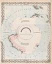
Keywords from Image Description:
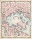
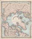
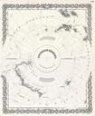
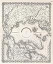
Colton Map of the Arctic or North Pole Geographicus NorthernRegionscolton. This rare hand colored map is copper plate engraving dating to by the well known th century American Mapmaker Colton It is representation of the North Pole and is formally titled Northern Regions This is rare and historically important map as the polar