Related Images

Download:
| Tiny | 107x128 | View | Download |
| Small | 214x256 | View | Download |
| Medium | 428x512 | View | Download |
| Large | 857x1024 | View | Download |
| Original | 3350x4000 | View | Download |
This image was acquired from
wikimedia. It was marked as Public Domain or CC0 and is free to use. To verify, go to the source and check the information there.
Looking for more info about this image?
Try a Google Reverse Image Search for it.
Try a Google Reverse Image Search for it.
Keywords from Image Description:
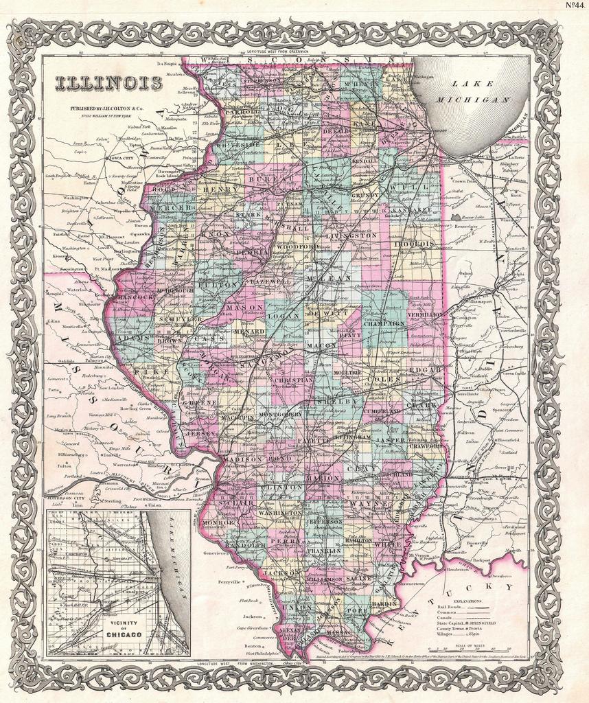
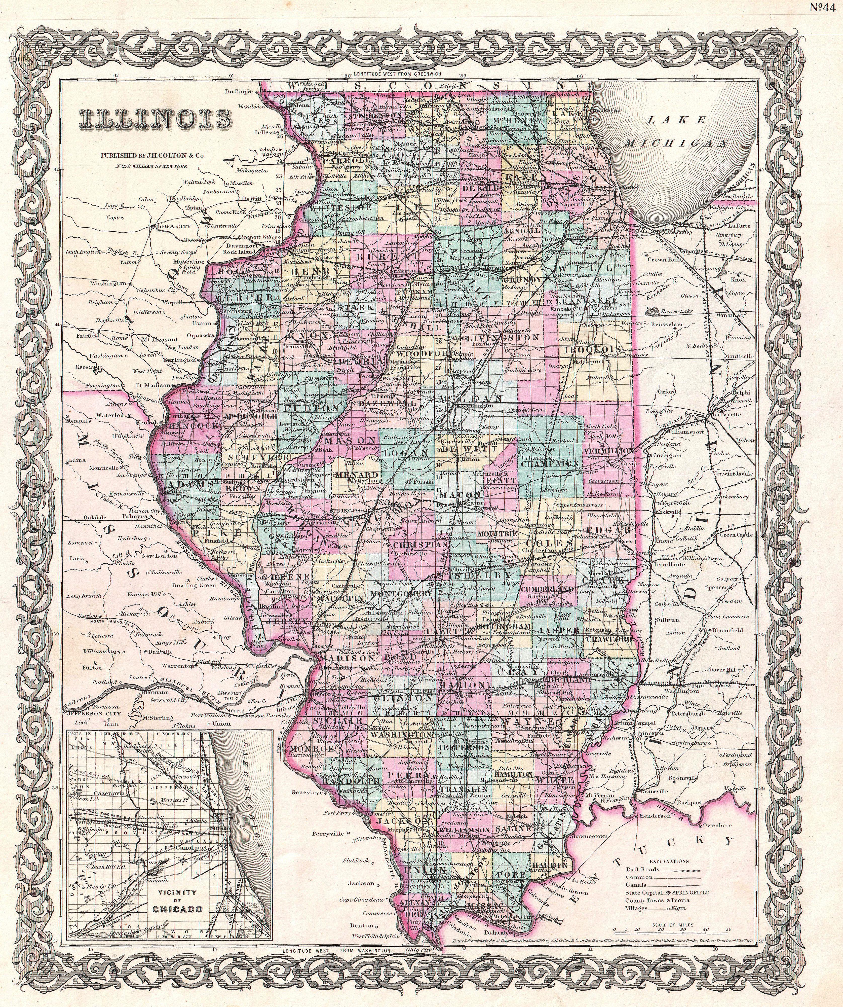
Colton Map of Illinois Geographicus ILcolton. This is the issue of Colton map of Illinois Depicts the state of Illinois along with parts of neighboring Iowa Missouri Indiana and Kentucky Color coded according to county Shows major roadways and railroads as well as geological features such as lakes and rivers An inset in the lower