
Related Images

Download:
| Tiny | 155x128 | View | Download |
| Small | 311x256 | View | Download |
| Medium | 622x512 | View | Download |
| Large | 1244x1024 | View | Download |
| Original | 4000x3292 | View | Download |
This image was acquired from
wikimedia. It was marked as Public Domain or CC0 and is free to use. To verify, go to the source and check the information there.
Looking for more info about this image?
Try a Google Reverse Image Search for it.
Try a Google Reverse Image Search for it.
Keywords from Image Description:
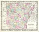
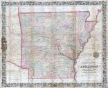
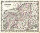
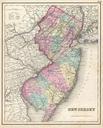
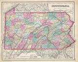
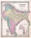
Colton Map of Arkansas Geographicus Arkansascolton. This rare hand colored map of Arkansas is copper plate engraving dating to Produced by the important mid th century American map publisher Colton Covers the region in considerable detail documenting roads railroads canals counties and topographical features Prepared out of Colton's