
Related Images


Download:
| Tiny | 90x128 | View | Download |
| Small | 181x256 | View | Download |
| Medium | 363x512 | View | Download |
| Large | 726x1024 | View | Download |
| Original | 3194x4500 | View | Download |
This image was acquired from
wikimedia. It was marked as Public Domain or CC0 and is free to use. To verify, go to the source and check the information there.
Looking for more info about this image?
Try a Google Reverse Image Search for it.
Try a Google Reverse Image Search for it.
Keywords from Image Description:
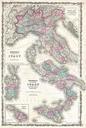
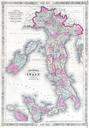
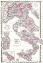
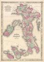
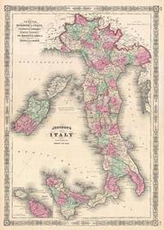
Johnson Map of Italy Geographicus Italyjohnson. Johnson beautifully hand colored map of Italy This map shows cities topographical features railways ferries and roads with color coding at the regional level Johnson introduced this map in replacing an earlier map of Italy that divided the peninsula into northern Italy consisting