Related Images


Download:
| Tiny | 106x128 | View | Download |
| Small | 212x256 | View | Download |
| Medium | 424x512 | View | Download |
| Large | 849x1024 | View | Download |
| Original | 4977x6000 | View | Download |
This image was acquired from
wikimedia. It was marked as Public Domain or CC0 and is free to use. To verify, go to the source and check the information there.
Looking for more info about this image?
Try a Google Reverse Image Search for it.
Try a Google Reverse Image Search for it.
Keywords from Image Description:
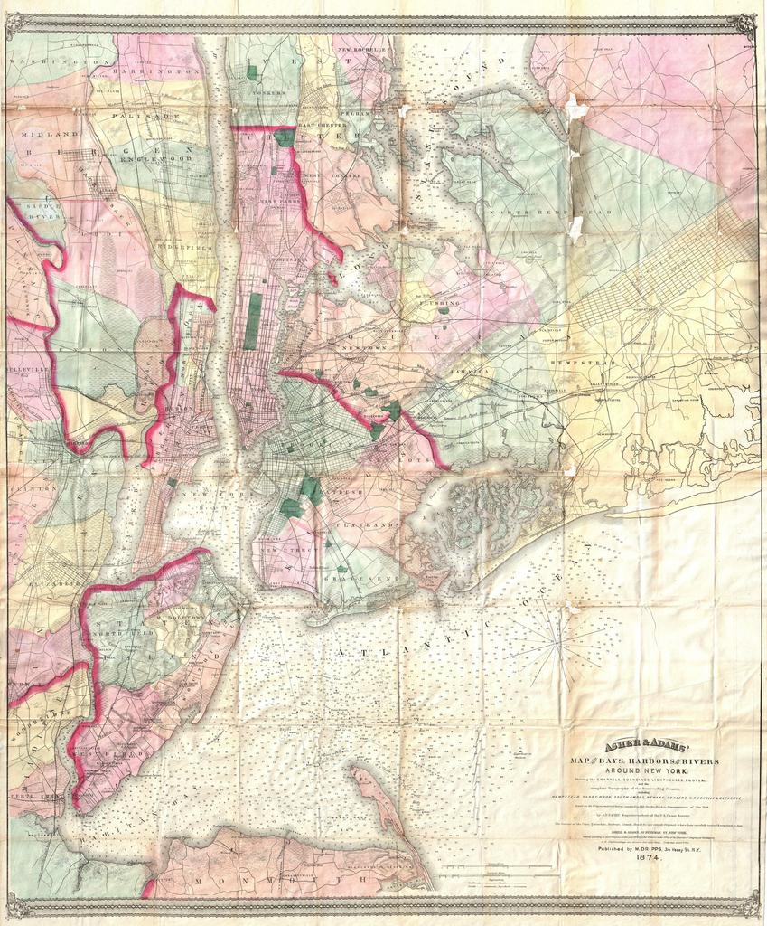
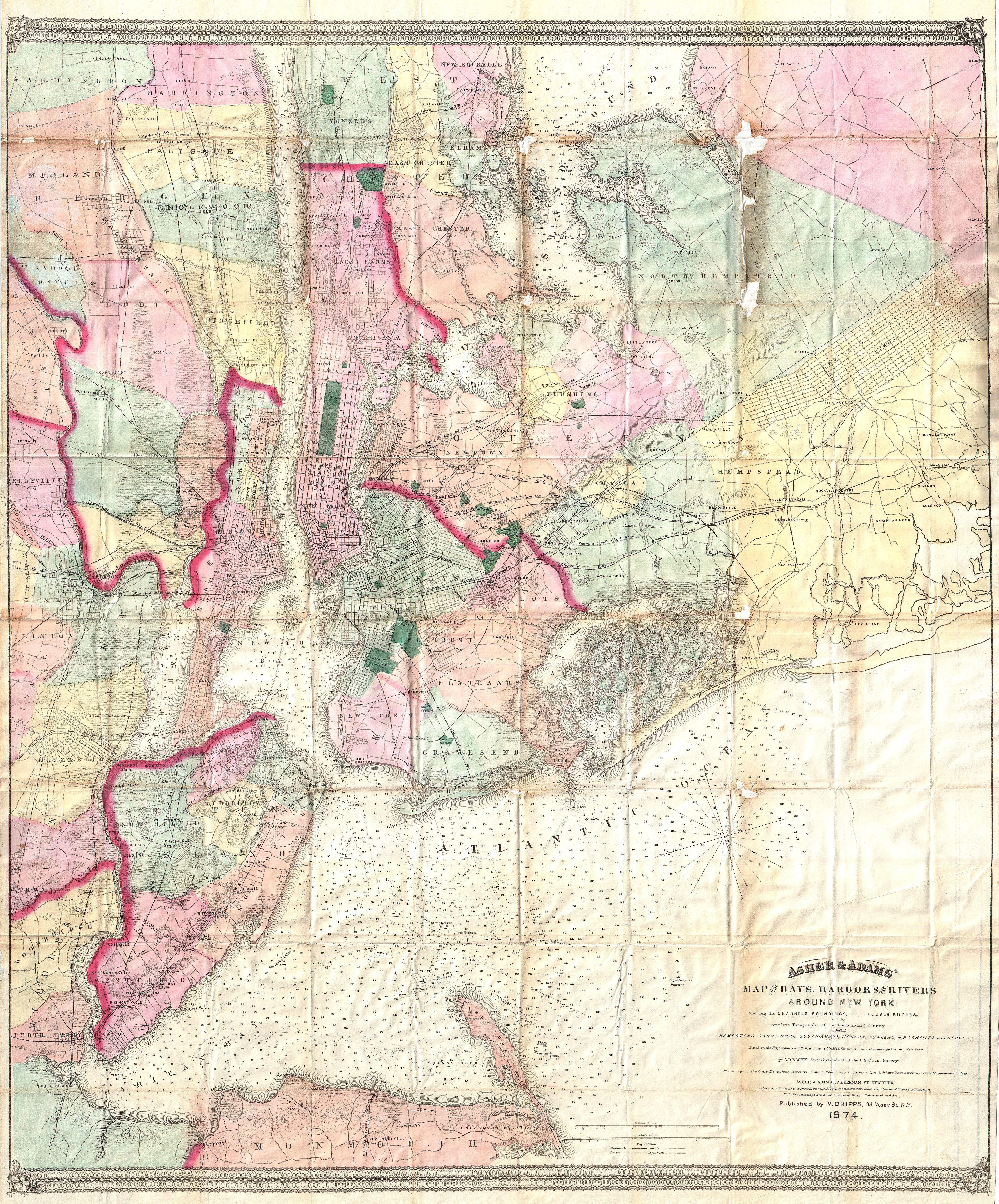
Dripps Map of the Bays Harbors and Rivers around New York City New York Geographicus NewYorkasheradams. visually stunning and extremely rare pocket map of the greater New York City area innovatively combining detailed land surveys with the work of the Coast Survey Covers the New York City area from Sandy Hook and Monmouth County