Related Images


Download:
| Tiny | 107x128 | View | Download |
| Small | 214x256 | View | Download |
| Medium | 429x512 | View | Download |
| Large | 859x1024 | View | Download |
| Original | 4000x4764 | View | Download |
This image was acquired from
wikimedia. It was marked as Public Domain or CC0 and is free to use. To verify, go to the source and check the information there.
Looking for more info about this image?
Try a Google Reverse Image Search for it.
Try a Google Reverse Image Search for it.
Keywords from Image Description:
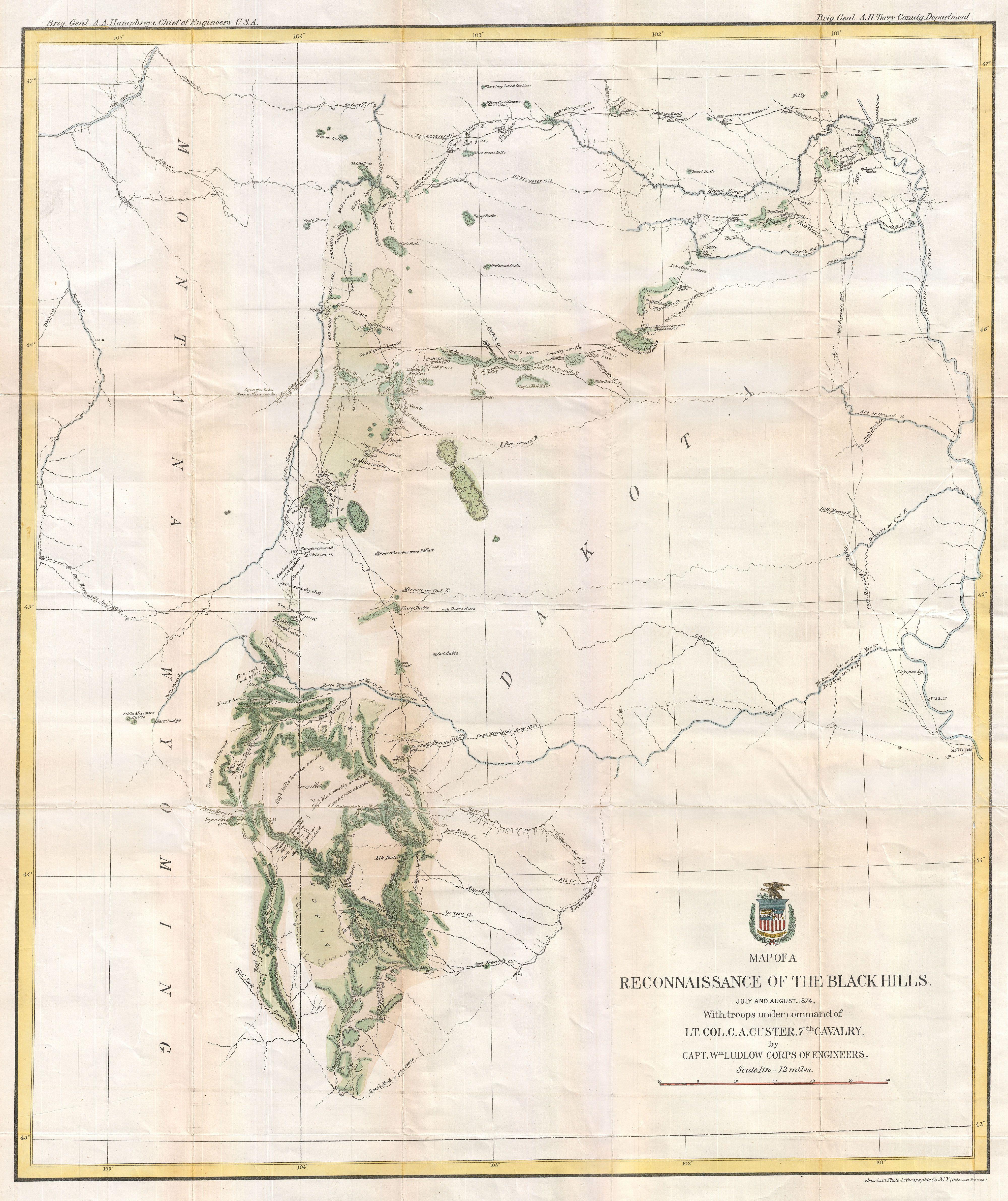
Ludlow and Custer Map of The Black Hills Geographicus BlackHillscuster. George Armstrong Custer and William Ludlow's seminal map of the Black Hills Dakota Territory covering from the Missouri to the Powder River and from the th to the rd parallel In one thousand cavalrymen under the command of Lt Col George Armstrong Custer