Related Images
Download:
| Tiny | 262x128 | View | Download |
| Small | 525x256 | View | Download |
| Medium | 1050x512 | View | Download |
| Large | 2101x1024 | View | Download |
| Original | 6000x2923 | View | Download |
This image was acquired from
wikimedia. It was marked as Public Domain or CC0 and is free to use. To verify, go to the source and check the information there.
Looking for more info about this image?
Try a Google Reverse Image Search for it.
Try a Google Reverse Image Search for it.
Keywords from Image Description:
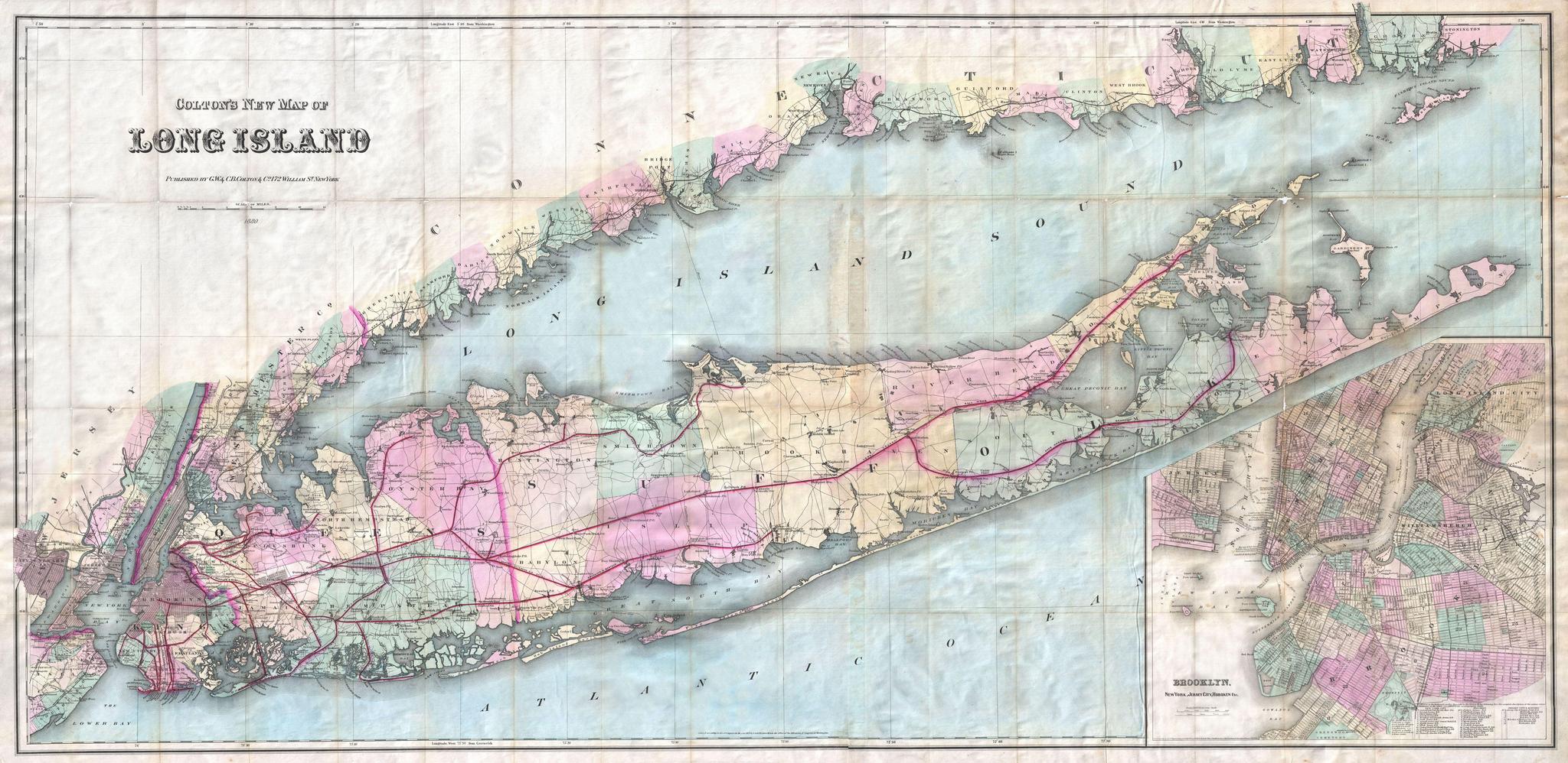
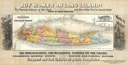
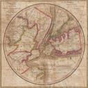
Colton Pocket Map of Long Island Geographicus LongIslandcolton. This is Colton's New Map of Long Island possibly the largest and most dramatic map of Long Island to appear in the th century Covers the region from Newark Staten Island and New York City eastward as far as Montauk and Fisher Island Includes the entirety of Long