
Related Images


Download:
| Tiny | 171x128 | View | Download |
| Small | 342x256 | View | Download |
| Medium | 684x512 | View | Download |
| Large | 1368x1024 | View | Download |
| Original | 4354x3259 | View | Download |
This image was acquired from
wikimedia. It was marked as Public Domain or CC0 and is free to use. To verify, go to the source and check the information there.
Looking for more info about this image?
Try a Google Reverse Image Search for it.
Try a Google Reverse Image Search for it.
Keywords from Image Description:
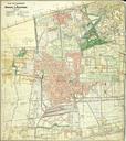
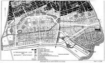
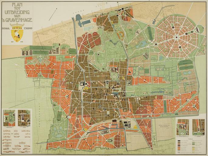
Plan tot uitbreiding van 'sGravenhage Plan Berlage. nl Plattegrond van Den Haag uit waarop aangegeven het stedenbouwkundig plan dat architect Hendrik Berlage had ontwikkeld om de bebouwing van Den Haag uit te breiden en Map of The Hague of on which shown the urban development plan designed by architect Hendrik Berlage de Karte