
Related Images


Download:
| Tiny | 45x128 | View | Download |
| Small | 91x256 | View | Download |
| Medium | 182x512 | View | Download |
| Large | 365x1024 | View | Download |
| Original svg | 367x1029 | View | Download |
| Original as jpg | 367x1029 | View | Download |
This image was acquired from
wikimedia. It was marked as Public Domain or CC0 and is free to use. To verify, go to the source and check the information there.
Looking for more info about this image?
Try a Google Reverse Image Search for it.
Try a Google Reverse Image Search for it.
Keywords from Image Description:
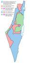
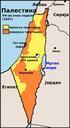
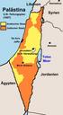
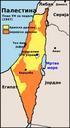
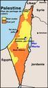
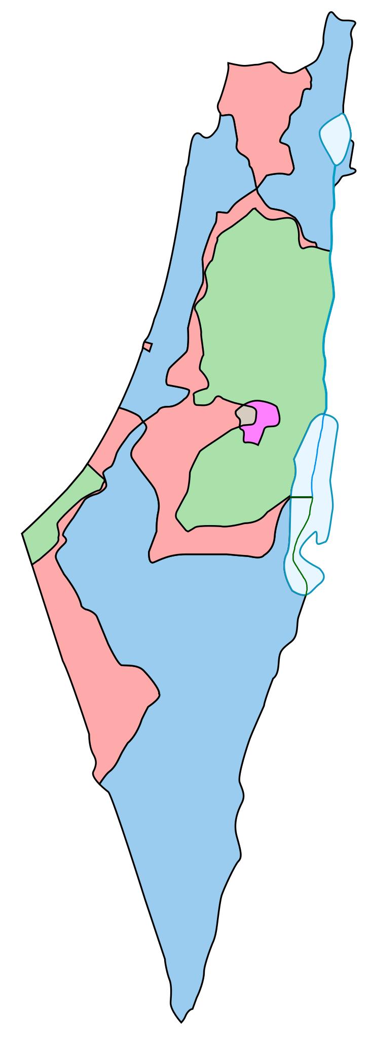
UNPartitionPlanArmisticeComparison.svg Resolution for the British Mandate Territory of Palestine and the eventual armistice boundaries of The meaning of the map colors is as follows legend caption is available in template form here Blue area assigned to Jewish state in the original UN partition plan and within the Israel armistice