
Related Images


Download:
| Tiny | 230x128 | View | Download |
| Small | 461x256 | View | Download |
| Medium | 923x512 | View | Download |
| Original svg | 1152x639 | View | Download |
| Original as jpg | 1152x639 | View | Download |
This image was acquired from
wikimedia. It was marked as Public Domain or CC0 and is free to use. To verify, go to the source and check the information there.
Looking for more info about this image?
Try a Google Reverse Image Search for it.
Try a Google Reverse Image Search for it.
Keywords from Image Description:
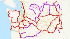
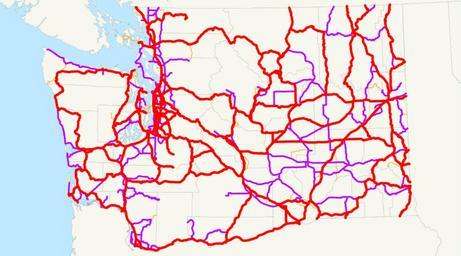
Washington state highways primarysecondary.svg This is map of the state highways in Washington as they existed in just before the old primarysecondary split was removed Primary routes are red and secondary routes are purple Thin orange is just current routes Email me if you would like copy of the GIS data created for the highways