
Related Images


Download:
| Tiny | 125x128 | View | Download |
| Original png | 179x182 | View | Download |
| Original as jpg | 179x182 | View | Download |
This image was acquired from
wikimedia. It was marked as Public Domain or CC0 and is free to use. To verify, go to the source and check the information there.
Looking for more info about this image?
Try a Google Reverse Image Search for it.
Try a Google Reverse Image Search for it.
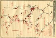
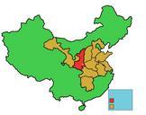
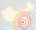
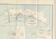
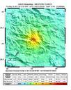
Keywords from Image Description:
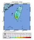
Latur earthquake map. Latur earthquake near Maharashtra usgs gov United States Geological Survey Public domain PDUSGov Earthquakes of Maps of Maharashtra Earthquake maps Original upload log bytes NazeBoK no Latur earthquake near Maharashtra usgs gov United States Geological Survey