Related Images


Download:
| Tiny | 183x128 | View | Download |
| Small | 366x256 | View | Download |
| Original png | 531x371 | View | Download |
| Original as jpg | 531x371 | View | Download |
This image was acquired from
wikimedia. It was marked as Public Domain or CC0 and is free to use. To verify, go to the source and check the information there.
Looking for more info about this image?
Try a Google Reverse Image Search for it.
Try a Google Reverse Image Search for it.
Keywords from Image Description:
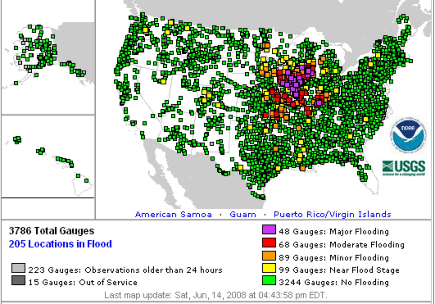
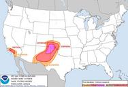
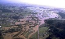
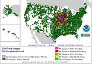
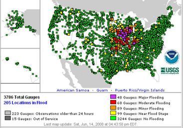
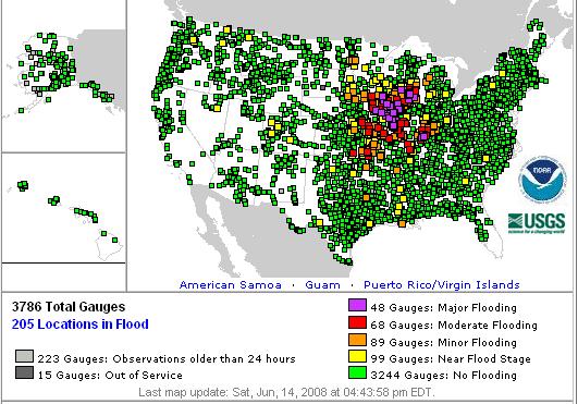
NOAA flooding overview. en map showing all observed locations for water level in the United States on June during historic flooding in the Midwest Yellow is near flood stage orange is minor flooding red moderate flooding and purple major flooding Green denotes no flooding National Oceanic and Atmospheric Administration NOAA weather