
Related Images


Download:
| Tiny | 159x128 | View | Download |
| Small | 319x256 | View | Download |
| Medium | 639x512 | View | Download |
| Large | 1278x1024 | View | Download |
| Original tiff | 9156x7331 | View | Download |
| Original as jpg | 9156x7331 | View | Download |
This image was acquired from
wikimedia. It was marked as Public Domain or CC0 and is free to use. To verify, go to the source and check the information there.
Looking for more info about this image?
Try a Google Reverse Image Search for it.
Try a Google Reverse Image Search for it.
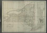
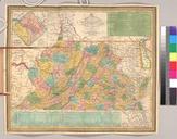
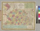
Keywords from Image Description:
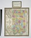
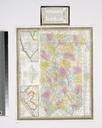
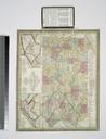
A map of the State of New York exhibiting the situation and boundaries of the counties and towns and the number of inhabitants in each according to the census of ... NYPL. map of the State of New York exhibiting the situation and boundaries of the counties and towns and the number of inhabitants in each according to the census