
Related Images


Download:
| Tiny | 172x128 | View | Download |
| Small | 345x256 | View | Download |
| Medium | 691x512 | View | Download |
| Large | 1382x1024 | View | Download |
| Original | 4570x3386 | View | Download |
This image was acquired from
wikimedia. It was marked as Public Domain or CC0 and is free to use. To verify, go to the source and check the information there.
Looking for more info about this image?
Try a Google Reverse Image Search for it.
Try a Google Reverse Image Search for it.
Keywords from Image Description:
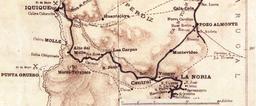
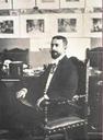
AlejandroBertrand. This official map of Chile partially reproduced here 'was drawn up on the orders of the Chilean Government for use in primary schools in the Republic and with view to the most recent data' by Alejandro Bertrand in The author an engineer was member of the Boundary Commissions charged with marking out the ChileanArgentine