
Related Images


Download:
| Tiny | 96x128 | View | Download |
| Small | 192x256 | View | Download |
| Medium | 384x512 | View | Download |
| Original | 768x1024 | View | Download |
This image was acquired from
wikimedia. It was marked as Public Domain or CC0 and is free to use. To verify, go to the source and check the information there.
Looking for more info about this image?
Try a Google Reverse Image Search for it.
Try a Google Reverse Image Search for it.
Keywords from Image Description:
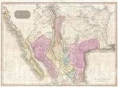
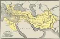
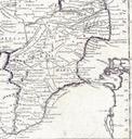
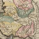
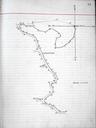
Alexander Commission Map . en Map on scale of in the original from the official proceedings of the binational commission presided by engineer arbitrator Gen Edward Porter Alexander to define the frontier between the Republics of Nicaragua and Costa Rican in accordance with the CaasJerez Treaty of the Arbitration Award by President