
Related Images


Download:
| Tiny | 163x128 | View | Download |
| Small | 326x256 | View | Download |
| Medium | 653x512 | View | Download |
| Large | 1306x1024 | View | Download |
| Original | 2222x1742 | View | Download |
This image was acquired from
wikimedia. It was marked as Public Domain or CC0 and is free to use. To verify, go to the source and check the information there.
Looking for more info about this image?
Try a Google Reverse Image Search for it.
Try a Google Reverse Image Search for it.
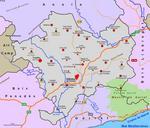
Keywords from Image Description:
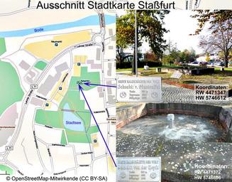
AltKalischchteStafurt. de Ungefhre Lage der Schchte Heydt und Manteuffel OpenStreetMap Foundation OSMF ein eigenes eingefgtes Foto openstreetmap org lat lon zoom layers OpenStreetMap Foundation OSMF Integrierte Fotos Eigentum Dr Gnter Pinzke aufgenommen Recherche Einzeichnung Dr Gnter Pinzke AttributionShareAlike Unported