
Related Images


Download:
| Tiny | 177x128 | View | Download |
| Small | 355x256 | View | Download |
| Medium | 711x512 | View | Download |
| Large | 1423x1024 | View | Download |
| Original | 2400x1726 | View | Download |
This image was acquired from
wikimedia. It was marked as Public Domain or CC0 and is free to use. To verify, go to the source and check the information there.
Looking for more info about this image?
Try a Google Reverse Image Search for it.
Try a Google Reverse Image Search for it.
Keywords from Image Description:
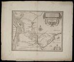
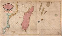
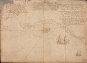
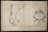
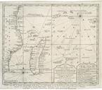
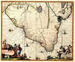
AMHNA Map of Rio de St. Juan Damaba to Cerapa and part of Madagascar. Artwork nl Kaart van Rio de St Juan Damaba tot Cerapa en een deel van Madagascar nl Titel in catalogus Leupe Nationaal Archief Kaart van de Oostkust van Afrika tusschen Rio de St Juan Damaba en Cerapa en een gedeelte van Madagaskar Rechtsboven genummerd Notities