Related Images


Download:
| Tiny | 161x128 | View | Download |
| Small | 322x256 | View | Download |
| Medium | 645x512 | View | Download |
| Original | 750x595 | View | Download |
This image was acquired from
wikimedia. It was marked as Public Domain or CC0 and is free to use. To verify, go to the source and check the information there.
Looking for more info about this image?
Try a Google Reverse Image Search for it.
Try a Google Reverse Image Search for it.
Keywords from Image Description:
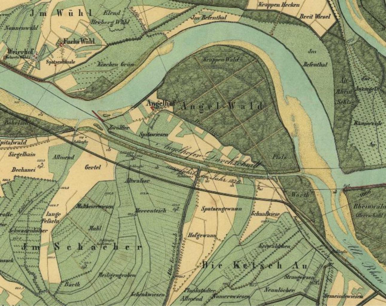
Angelwald. de Rheinkorrektion Angelhofer Durchschnitt bei Ketsch badenwuerttemberg de ungenannt PDold Straightening of the Rhine Angelhofer Altrhein maps Old maps of RhinelandPalatinate thcentury maps of BadenWrttemberg Maps of the Rhine