
Related Images


Download:
| Tiny | 102x128 | View | Download |
| Small | 205x256 | View | Download |
| Medium | 410x512 | View | Download |
| Large | 821x1024 | View | Download |
| Original svg | 999x1246 | View | Download |
| Original as jpg | 999x1246 | View | Download |
This image was acquired from
wikimedia. It was marked as Public Domain or CC0 and is free to use. To verify, go to the source and check the information there.
Looking for more info about this image?
Try a Google Reverse Image Search for it.
Try a Google Reverse Image Search for it.
Keywords from Image Description:
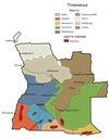
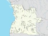
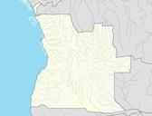
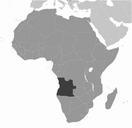
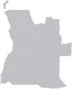
Angola municipalities map.svg en blank map of the municipalities of Angola as of July This map was compiled by converting United Nations SALB Second Level Administrative Boundaries data into an SVG with org kartograph and making adjustments for recently created municipalities in Inkscape own xFE other versions cczero Maps of