
Related Images


This image was acquired from
wikimedia. It was marked as Public Domain or CC0 and is free to use. To verify, go to the source and check the information there.
Looking for more info about this image?
Try a Google Reverse Image Search for it.
Try a Google Reverse Image Search for it.
Keywords from Image Description:
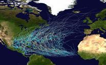
Atlantic Ocean satellite image location map. Positionskarte des Atlantischen Ozeans Quadratische Plattkarte Geographische Begrenzung der Karte Location map of the Atlantic Ocean Equirectangular projection Geographic limits of the map Own using file Earthmapxcompac NordNordWest Kartenwerkstatt Location maps standard Files by NordNordWest