
Related Images


Download:
| Tiny | 151x128 | View | Download |
| Small | 303x256 | View | Download |
| Medium | 606x512 | View | Download |
| Original | 1095x925 | View | Download |
This image was acquired from
wikimedia. It was marked as Public Domain or CC0 and is free to use. To verify, go to the source and check the information there.
Looking for more info about this image?
Try a Google Reverse Image Search for it.
Try a Google Reverse Image Search for it.
Keywords from Image Description:
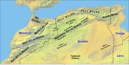
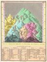
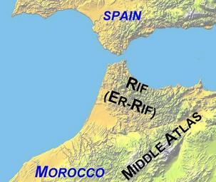
AtlasMountainsLabeled new. Map of Northwest Africa showing mountain ranges and political boundaries Made by author Cropped from NASA source and labelled using Debenham Frank Reader's Digest Great World Atlas rd edition London Reader's Digest Association Great Britain ISBN for location of named features June UTC jpl nasa gov