
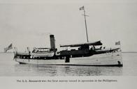
Related Images


Download:
| Tiny | 153x128 | View | Download |
| Small | 307x256 | View | Download |
| Medium | 614x512 | View | Download |
| Large | 1228x1024 | View | Download |
| Original | 1442x1202 | View | Download |
This image was acquired from
wikimedia. It was marked as Public Domain or CC0 and is free to use. To verify, go to the source and check the information there.
Looking for more info about this image?
Try a Google Reverse Image Search for it.
Try a Google Reverse Image Search for it.
Keywords from Image Description:
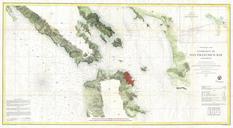
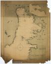
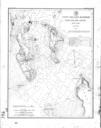
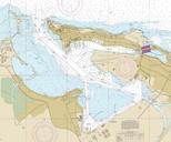
Baha de San Juan NOAA Office of Coast Survey. en This is screen shot of map available for public usage at the US agency National Oceanic and Atmospheric Administration United States government The shot was taken on December for use in This is screen capture of the online viewable chart of the San Juan Bay available for public