Related Images


Download:
| Tiny | 108x128 | View | Download |
| Small | 217x256 | View | Download |
| Medium | 435x512 | View | Download |
| Large | 870x1024 | View | Download |
| Original | 2997x3525 | View | Download |
This image was acquired from
flickr. It was marked as Public Domain or CC0 and is free to use. To verify, go to the source and check the information there.
Looking for more info about this image?
Try a Google Reverse Image Search for it.
Try a Google Reverse Image Search for it.
Keywords from Image Description:
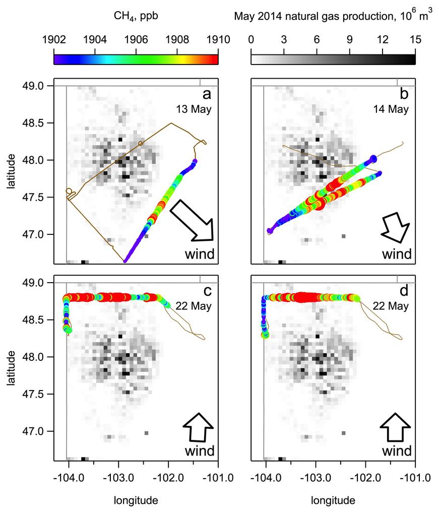
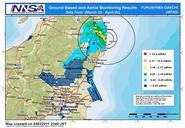
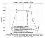
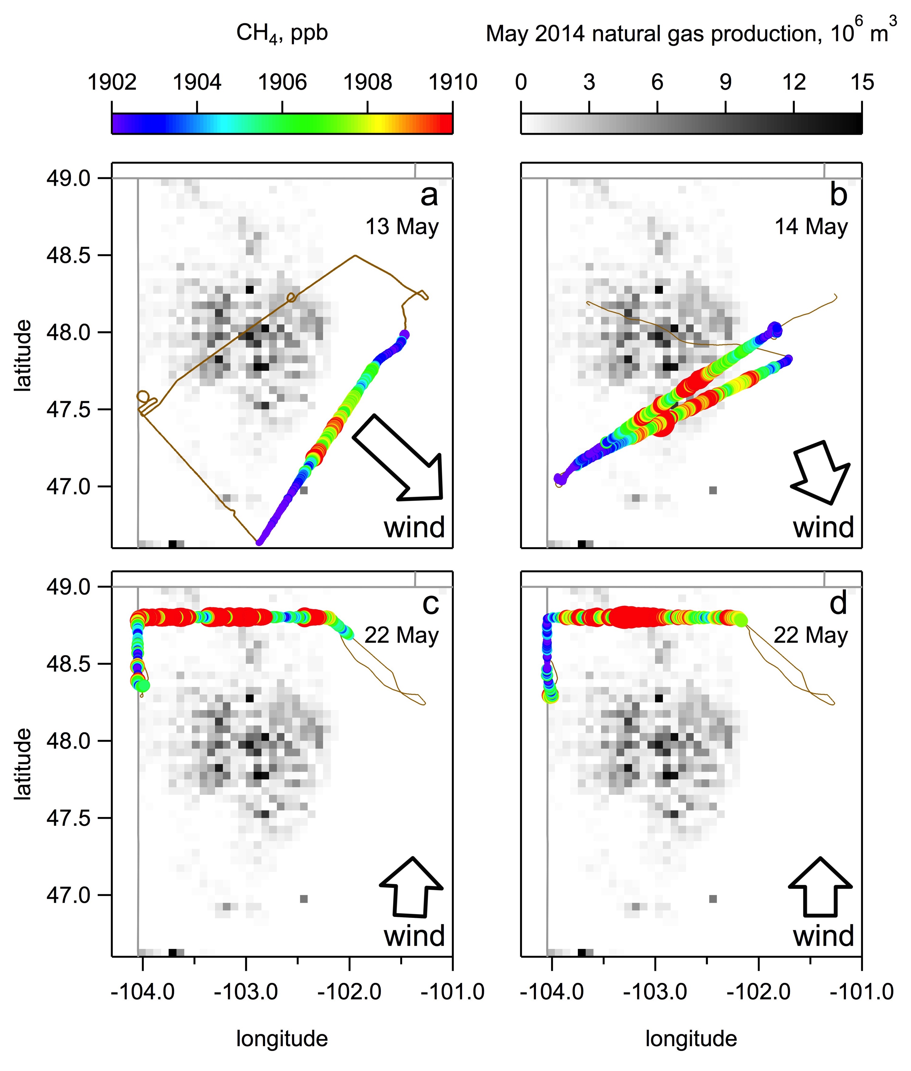
drawing text screenshot cartoon This map shows the five NOAA Twin Otter aircraft transects used to calculate methane emissions downwind of the Bakken region. North Dakota natural gas production is summed into grids the darker the grid the more natural gas was produced. The brown flight track is colored by methane measured from the