
Related Images


Download:
| Tiny | 167x128 | View | Download |
| Small | 334x256 | View | Download |
| Medium | 668x512 | View | Download |
| Large | 1336x1024 | View | Download |
| Original png | 1509x1156 | View | Download |
| Original as jpg | 1509x1156 | View | Download |
This image was acquired from
wikimedia. It was marked as Public Domain or CC0 and is free to use. To verify, go to the source and check the information there.
Looking for more info about this image?
Try a Google Reverse Image Search for it.
Try a Google Reverse Image Search for it.
Keywords from Image Description:
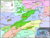
Bald Eagle State Forest. en January Map created using ArcMap with Service Pack by Raymond Crew Data layers from ESRI Data PA DCNR data and USGS data Exported as dpi file from ArcMap en Premeditated Chaos CommonsHelper Rcc en Rcc Original upload log page en BaldEagle Rcc bytes no correction plus reduced number of