
Related Images


Download:
| Tiny | 151x128 | View | Download |
| Small | 302x256 | View | Download |
| Medium | 605x512 | View | Download |
| Original | 737x623 | View | Download |
This image was acquired from
wikimedia. It was marked as Public Domain or CC0 and is free to use. To verify, go to the source and check the information there.
Looking for more info about this image?
Try a Google Reverse Image Search for it.
Try a Google Reverse Image Search for it.
Keywords from Image Description:
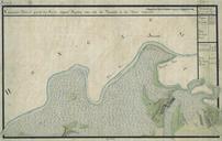
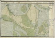
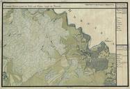
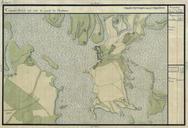
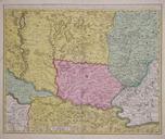
Banat. en Copper engraving hand colored in outline and wash when published This map shows southern parts of the Habsburg Kingdom of Hungary with the neighboring Ottoman Province of Temevar the southwestern part of Transylvania and the northern part of the neighboring Ottoman Sanjak of Semendire This map by Schenk is based on the