
Related Images


Download:
| Tiny | 119x128 | View | Download |
| Small | 239x256 | View | Download |
| Original png | 326x349 | View | Download |
| Original as jpg | 326x349 | View | Download |
This image was acquired from
wikimedia. It was marked as Public Domain or CC0 and is free to use. To verify, go to the source and check the information there.
Looking for more info about this image?
Try a Google Reverse Image Search for it.
Try a Google Reverse Image Search for it.
Keywords from Image Description:
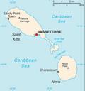
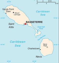
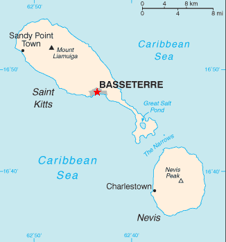
Basseterre Map . The Grey Area Around the Red Star Indicates the Location and City Limits of the City of Basseterre on the Island of St Kitts Basseterren kaupungin sijainti on merkitty karttaan punaisella thdell Based on Image SaintKittsandNevisCIAWFBMap br from org en Star colour changed by Jensonmortonbr uploader was Jensonmorton