Related Images


Download:
| Tiny | 87x128 | View | Download |
| Small | 174x256 | View | Download |
| Medium | 349x512 | View | Download |
| Large | 699x1024 | View | Download |
| Original | 2679x3920 | View | Download |
This image was acquired from
wikimedia. It was marked as Public Domain or CC0 and is free to use. To verify, go to the source and check the information there.
Looking for more info about this image?
Try a Google Reverse Image Search for it.
Try a Google Reverse Image Search for it.
Keywords from Image Description:
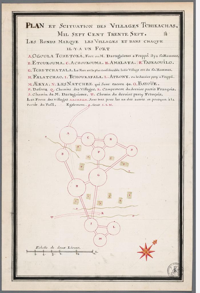
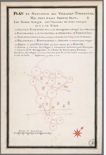
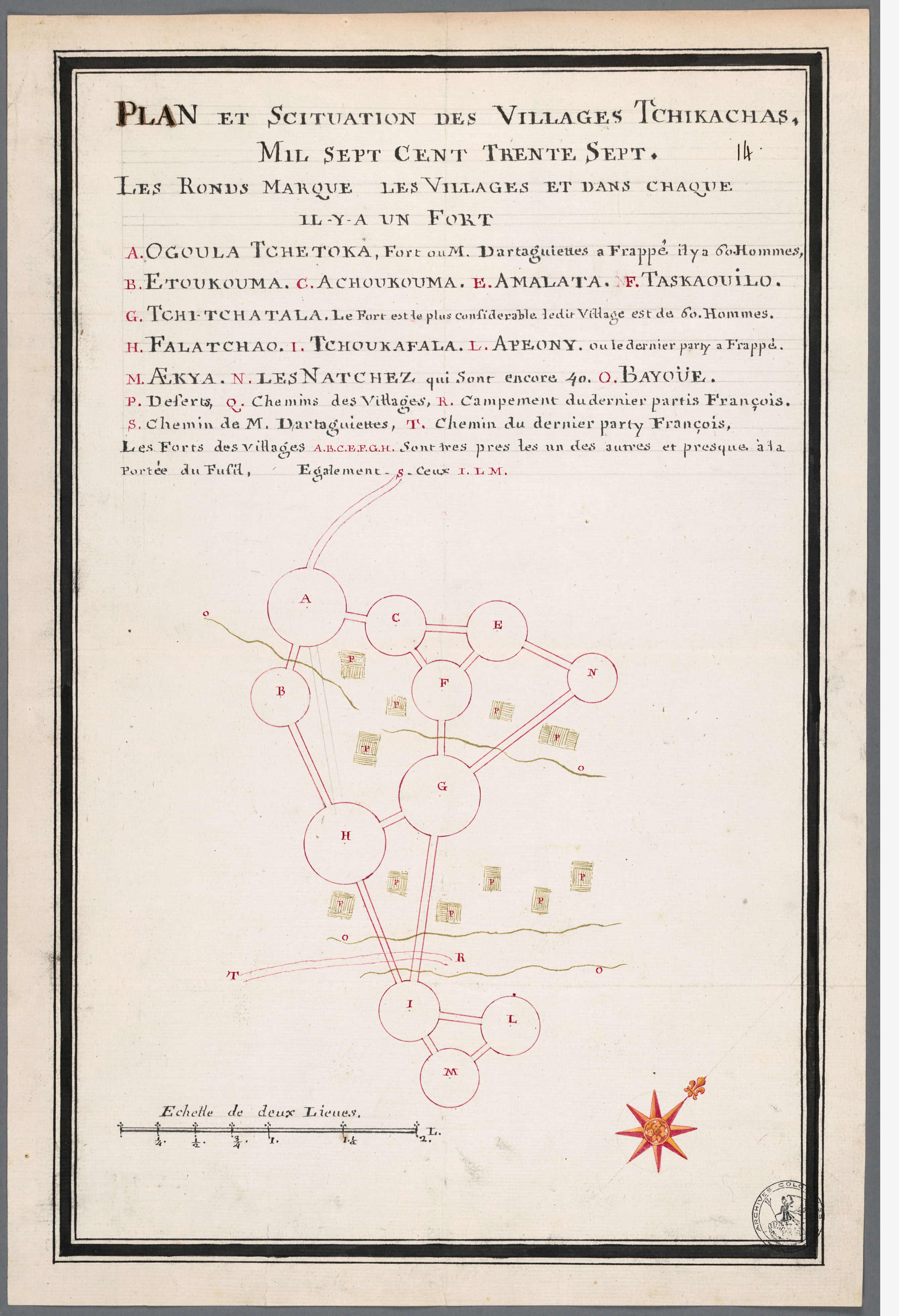
BatzChickasawVillages SEMC F. archivescanadafrance org xsp qid sdxq acfdb id FRCAOMF This map is described by Gregory Waselkov in Indian Maps of the Southeast which is published in Powhatan's Mantle Indians in the Colonial Southeast ISBN pp Creator Alexandre de Batz This image is in the public domain due to its age PDold Chickasaw