
Related Images


Download:
| Tiny | 82x128 | View | Download |
| Small | 164x256 | View | Download |
| Medium | 328x512 | View | Download |
| Large | 657x1024 | View | Download |
| Original | 1080x1681 | View | Download |
This image was acquired from
wikimedia. It was marked as Public Domain or CC0 and is free to use. To verify, go to the source and check the information there.
Looking for more info about this image?
Try a Google Reverse Image Search for it.
Try a Google Reverse Image Search for it.
Keywords from Image Description:
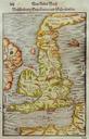
Beschreibung Engellandts und Schottlandts. en semiPtolemaic map of England and Wales with Ptolemy's Scotland turned at right angle to the north and part of Ireland showing maphouse co uk Maphouse Ptolemy Sebastian Mnster other versions PDold maps Book pages in German Maps in Latin Ptolemaic Britain Cosmographia Mnster Ptolemaic