
Related Images


Download:
| Tiny | 149x128 | View | Download |
| Small | 298x256 | View | Download |
| Medium | 596x512 | View | Download |
| Original | 1012x868 | View | Download |
This image was acquired from
wikimedia. It was marked as Public Domain or CC0 and is free to use. To verify, go to the source and check the information there.
Looking for more info about this image?
Try a Google Reverse Image Search for it.
Try a Google Reverse Image Search for it.
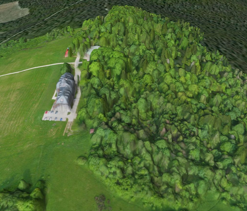
Keywords from Image Description:
Bezmiechowa DSM Pteryx UAV. en Bezmiechowa airfield Digital Surface Model obtained after day of preflight testing hr of flight and day of processing using Pteryx UAV own Kbosak Topographic maps of Poland Bezmiechowa Airfield Aerial photographs of Subcarpathian Voivodeship Aerial photographs from Pteryx UAV