
Related Images


Download:
| Tiny | 87x128 | View | Download |
| Small | 175x256 | View | Download |
| Medium | 351x512 | View | Download |
| Large | 703x1024 | View | Download |
| Original | 1563x2274 | View | Download |
This image was acquired from
wikimedia. It was marked as Public Domain or CC0 and is free to use. To verify, go to the source and check the information there.
Looking for more info about this image?
Try a Google Reverse Image Search for it.
Try a Google Reverse Image Search for it.
Keywords from Image Description:
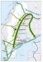
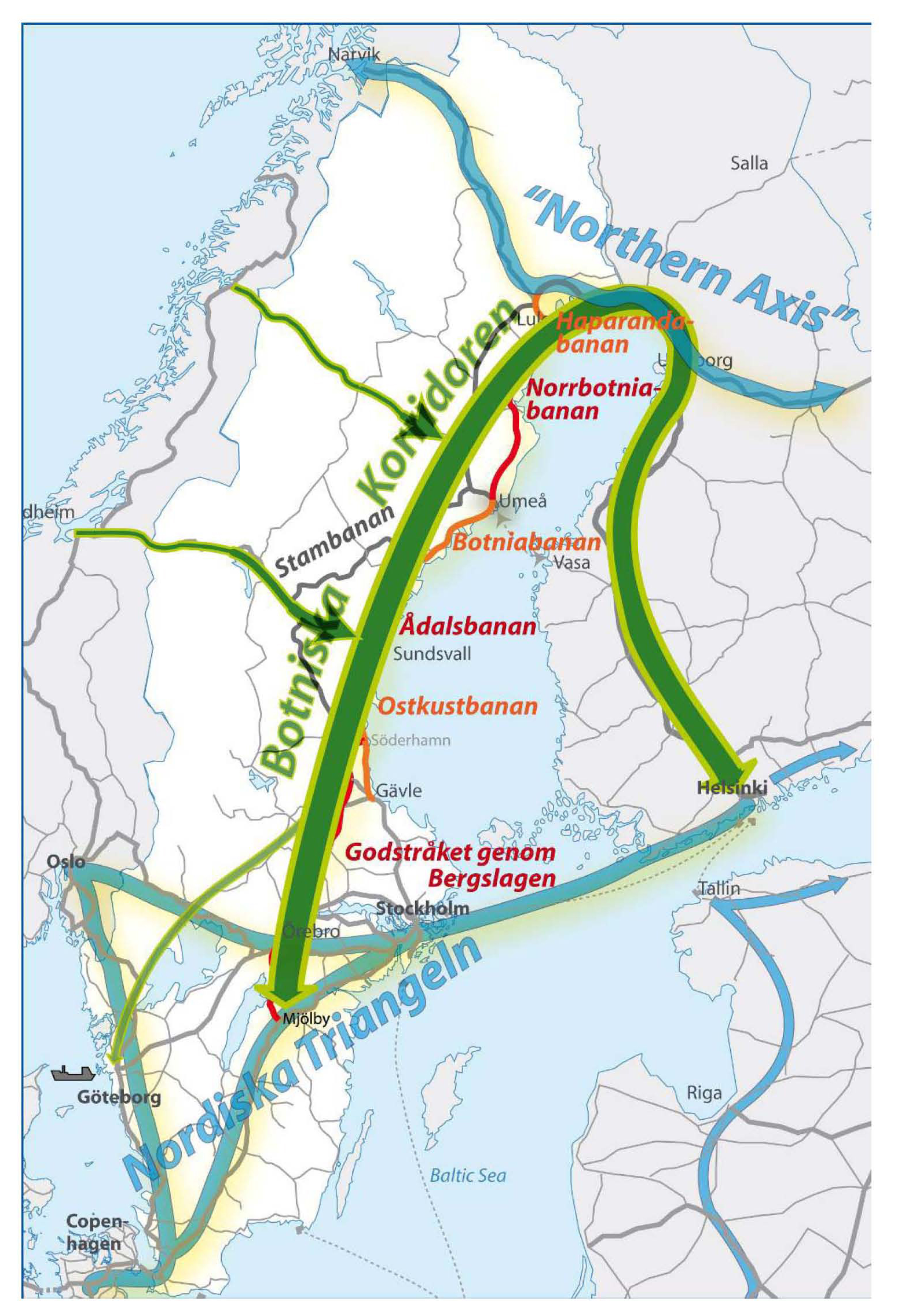
BK Page ren. sv Strkkarta ver Botniska korridoren som svl Sverige som Finland knyter samman den Nordiska Triangeln med den nordligaste delen av Northern Axis Bilden kommer frn projektet Botniska korridoren Projektet Botniska korridoren Transport maps of Sweden Transport maps of Finland Ferry maps