
Related Images


Download:
| Tiny | 176x128 | View | Download |
| Small | 352x256 | View | Download |
| Medium | 705x512 | View | Download |
| Original | 1005x729 | View | Download |
This image was acquired from
wikimedia. It was marked as Public Domain or CC0 and is free to use. To verify, go to the source and check the information there.
Looking for more info about this image?
Try a Google Reverse Image Search for it.
Try a Google Reverse Image Search for it.
Keywords from Image Description:
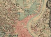
Bordeaux ferroviaire XIXe sicle. fr Carte d'tat major de Bordeaux montrant la gare SaintLouis au NordOuest et les raccordements du Midi vers le ParisOrlans au sortir de la passerelle Eiffel between Carte d'tat major author other versions Custom marker PDold Old maps of Bordeaux