
Related Images


Download:
| Tiny | 125x128 | View | Download |
| Small | 250x256 | View | Download |
| Original png | 437x446 | View | Download |
| Original as jpg | 437x446 | View | Download |
This image was acquired from
wikimedia. It was marked as Public Domain or CC0 and is free to use. To verify, go to the source and check the information there.
Looking for more info about this image?
Try a Google Reverse Image Search for it.
Try a Google Reverse Image Search for it.
Keywords from Image Description:
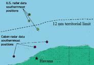
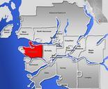
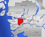
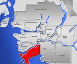
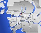
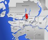
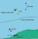
BTTR location of shootdown. The map shows the locations where the two planes of Brothers to the Rescue were reportedly shot down by Cuban MIG on February Finding many inconsistencies in US and Cuban data the ICAO investigation determined the most likely location to be that determined from information from the ship Majesty of the