Related Images


Download:
| Tiny | 80x128 | View | Download |
| Small | 161x256 | View | Download |
| Medium | 322x512 | View | Download |
| Large | 645x1024 | View | Download |
| Original svg | 945x1499 | View | Download |
| Original as jpg | 945x1499 | View | Download |
This image was acquired from
wikimedia. It was marked as Public Domain or CC0 and is free to use. To verify, go to the source and check the information there.
Looking for more info about this image?
Try a Google Reverse Image Search for it.
Try a Google Reverse Image Search for it.
Keywords from Image Description:
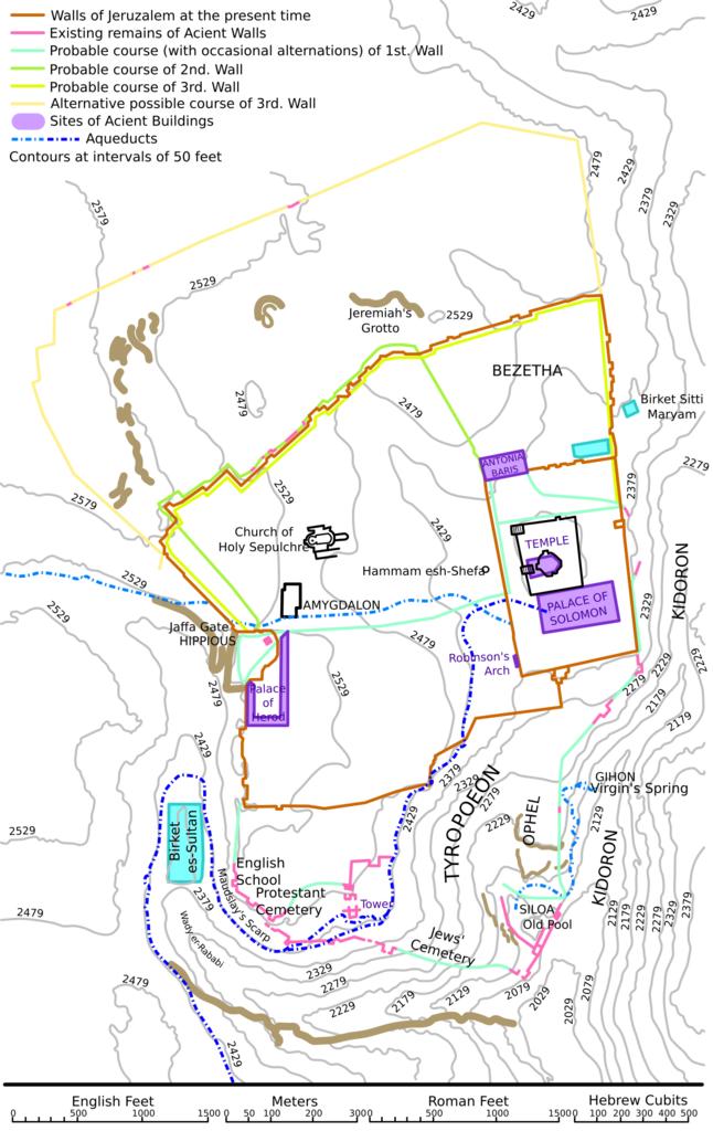
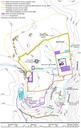
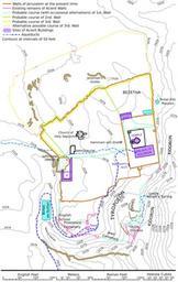
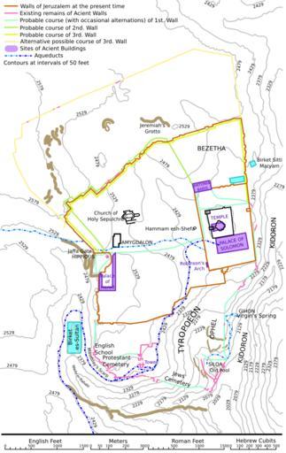
CBJerusalemMapWallsAndContours.svg en An illustration from the Encyclopaedia Biblica publication which is now in the public domain Map for article Jerusalem Plan of Ancient Jerusalem showing height contours aquaducts etc Artificially coloured from black white original to aid clarity own MHzas Maps of the history of Jerusalem Encyclopaedia


