
Related Images


Download:
| Tiny | 141x128 | View | Download |
| Small | 283x256 | View | Download |
| Medium | 566x512 | View | Download |
| Original svg | 1115x1007 | View | Download |
| Original as jpg | 1115x1007 | View | Download |
This image was acquired from
wikimedia. It was marked as Public Domain or CC0 and is free to use. To verify, go to the source and check the information there.
Looking for more info about this image?
Try a Google Reverse Image Search for it.
Try a Google Reverse Image Search for it.
Keywords from Image Description:
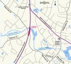
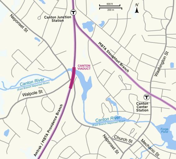
Canton Viaduct map.svg Map showing location of Canton Viaduct in Canton Massachusetts Own work by uploader using Quantum GIS and Inkscape based on public data from Office of Geographic and Environmental Information MassGIS Commonwealth of Massachusetts Executive Office of Environmental Affairs mass gov htm Created with Quantum