
Related Images


Download:
| Tiny | 151x128 | View | Download |
| Small | 302x256 | View | Download |
| Medium | 604x512 | View | Download |
| Large | 1209x1024 | View | Download |
| Original png | 2500x2116 | View | Download |
| Original as jpg | 2500x2116 | View | Download |
This image was acquired from
wikimedia. It was marked as Public Domain or CC0 and is free to use. To verify, go to the source and check the information there.
Looking for more info about this image?
Try a Google Reverse Image Search for it.
Try a Google Reverse Image Search for it.
Keywords from Image Description:
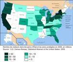
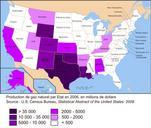
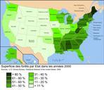
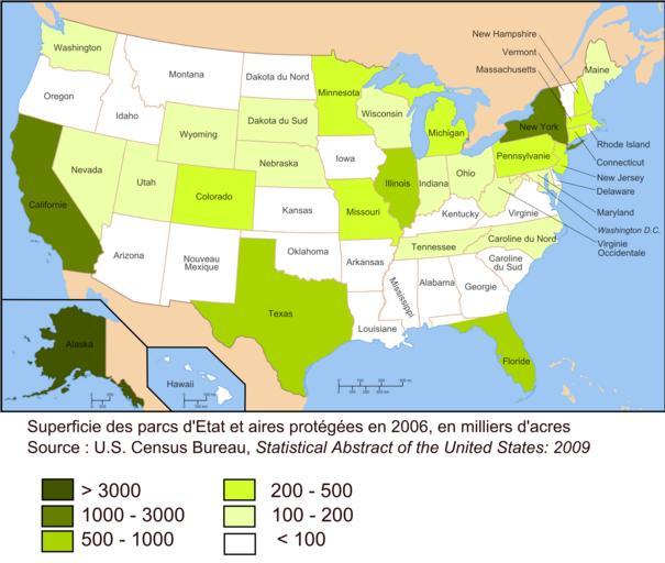
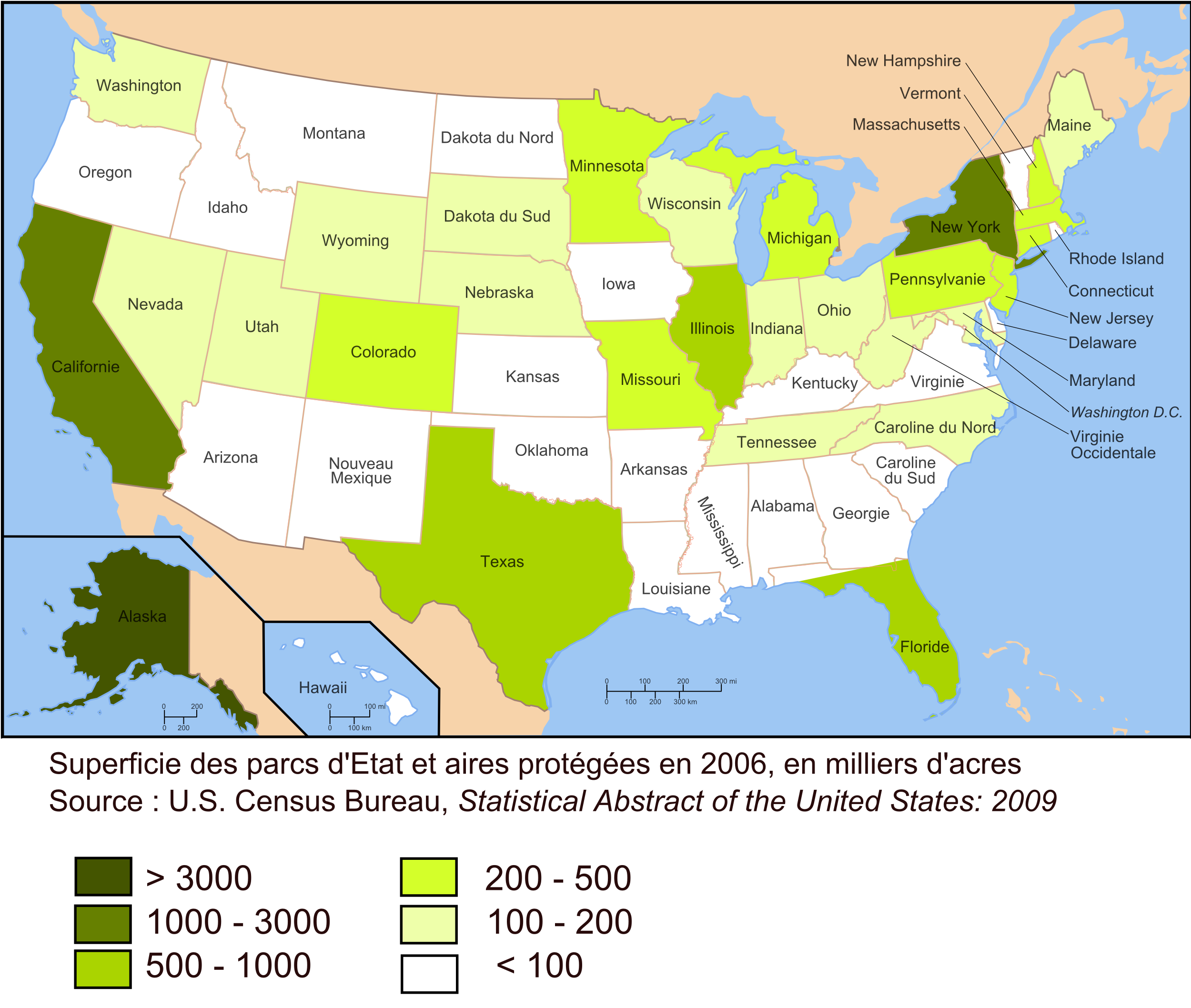
Carte aires protges USA . fr Carte des parcs d'Etat et des aires protges en en superficie Source Statistical Abstract US Bureau of Census en Frenchlabeled map of US state parks and protected areas in by area The legend figures are in thousands of acres Source Statistical Abstract US Bureau of Census Own Urban Maps of protected