Related Images


Download:
| Tiny | 98x128 | View | Download |
| Small | 197x256 | View | Download |
| Medium | 395x512 | View | Download |
| Large | 790x1024 | View | Download |
| Original | 2136x2766 | View | Download |
This image was acquired from
wikimedia. It was marked as Public Domain or CC0 and is free to use. To verify, go to the source and check the information there.
Looking for more info about this image?
Try a Google Reverse Image Search for it.
Try a Google Reverse Image Search for it.
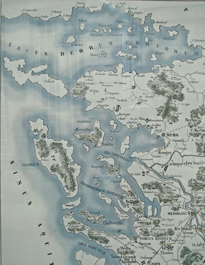
Keywords from Image Description:
Carte du pays de Santones sous les Romains Pertuis Antioche. fr CartedupaysdeSantonessouslesRomainsPertuisdAntioche Map by Auguste Lacurie before Detail of File CartedupaysdeSantonessouslesRomains Auguste Lacurie History of CharenteMaritime Old maps of CharenteMaritime Santones PDArt