
Related Images

Download:
| Tiny | 310x128 | View | Download |
| Small | 621x256 | View | Download |
| Medium | 1243x512 | View | Download |
| Original | 2207x909 | View | Download |
This image was acquired from
wikimedia. It was marked as Public Domain or CC0 and is free to use. To verify, go to the source and check the information there.
Looking for more info about this image?
Try a Google Reverse Image Search for it.
Try a Google Reverse Image Search for it.
Keywords from Image Description:
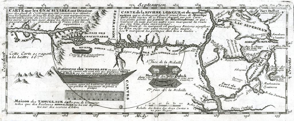
Carte que les Gnacsitares ont Dessine. en Map depicting Baron de Lahontan's imaginary westeast Long River Riviere Longue rising in distant western mountains and emptying into the upper Mississippi The map extends east to the Great Lakes to show Lac Superieur and Lac de Illinois Michigan along with number of the early French forts