
Related Images


Download:
| Tiny | 184x128 | View | Download |
| Small | 368x256 | View | Download |
| Medium | 736x512 | View | Download |
| Large | 1472x1024 | View | Download |
| Original | 2432x1691 | View | Download |
This image was acquired from
wikimedia. It was marked as Public Domain or CC0 and is free to use. To verify, go to the source and check the information there.
Looking for more info about this image?
Try a Google Reverse Image Search for it.
Try a Google Reverse Image Search for it.
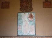
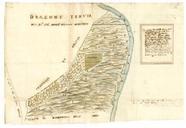
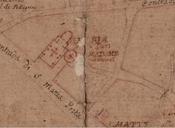
Keywords from Image Description:
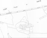
Castello di Montfleury mappa Catasto Francese Mont.jpeg it Particolare della mappa del Catasto Francese per masse di coltura del Plan de la Comune d'Aoste Dpart de la Doire Arrondissement comunal d'Aoste Canton Termin le Brumaire an par le Turno Gomtre en Chef et le Margery Arpenteur Castello di Montfleury Aosta Valle d'Aosta