
Related Images


Download:
| Tiny | 170x128 | View | Download |
| Small | 341x256 | View | Download |
| Medium | 682x512 | View | Download |
| Large | 1365x1024 | View | Download |
| Original | 2560x1920 | View | Download |
This image was acquired from
wikimedia. It was marked as Public Domain or CC0 and is free to use. To verify, go to the source and check the information there.
Looking for more info about this image?
Try a Google Reverse Image Search for it.
Try a Google Reverse Image Search for it.
Keywords from Image Description:
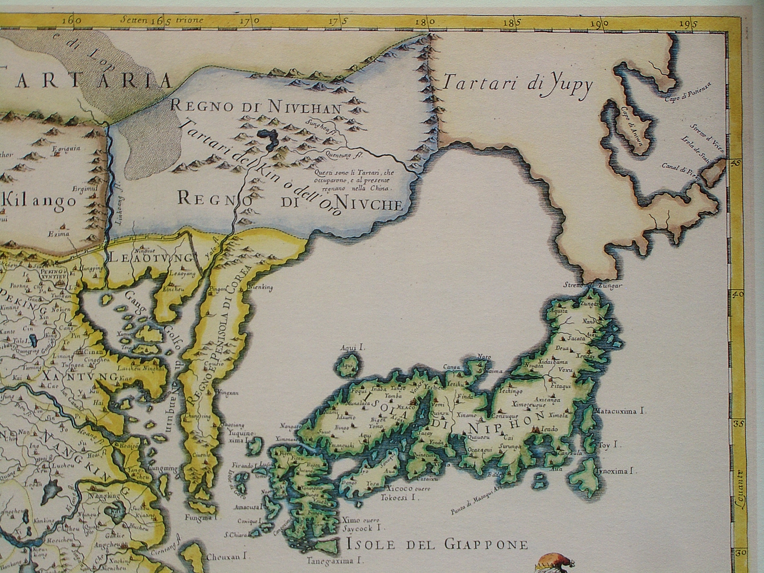
CEMNEcorner. en The northeastern cornet of map of China in Italian The Kingdom of China presently called Catay and Mangin divided into its principal provinces on most precise map This part shows includes Sea of Japan and Japan itself However neither the La Perouse Strait nor the Strait of Tartary were known to the cartographer and