
Related Images


Download:
| Tiny | 91x128 | View | Download |
| Small | 183x256 | View | Download |
| Medium | 367x512 | View | Download |
| Large | 735x1024 | View | Download |
| Original | 2082x2900 | View | Download |
This image was acquired from
wikimedia. It was marked as Public Domain or CC0 and is free to use. To verify, go to the source and check the information there.
Looking for more info about this image?
Try a Google Reverse Image Search for it.
Try a Google Reverse Image Search for it.
Keywords from Image Description:
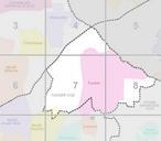
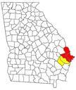
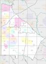
Census Block Map DeKalb County Georgia United States. DeKalb County Georgia United States showing DeKalb's five Census County Divisions ChambleeDoraville Tucker Stone Mountain Lithonia and AtlantaDecatur census gov pdf Department of Commerce Economics and Statistics Administration Census Bureau PDUSGov Uploaded with United