Download:
| Tiny | 90x128 | View | Download |
| Small | 181x256 | View | Download |
| Original svg | 210x297 | View | Download |
| Original as jpg | 210x297 | View | Download |
This image was acquired from
wikimedia. It was marked as Public Domain or CC0 and is free to use. To verify, go to the source and check the information there.
Looking for more info about this image?
Try a Google Reverse Image Search for it.
Try a Google Reverse Image Search for it.
Keywords from Image Description:
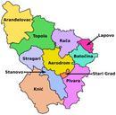
Central Equatoria district map overview.svg Map of Central Equatoria state with its districts' borders Located in the central Equatoria region of South Sudan NOTE shown in former southern Sudan province without new independent Republic of South Sudan national boundaries own work based on Image Sudan district map svg de user Svensteffen


