
Related Images


Download:
| Tiny | 98x128 | View | Download |
| Small | 196x256 | View | Download |
| Medium | 392x512 | View | Download |
| Large | 785x1024 | View | Download |
| Original png | 1455x1896 | View | Download |
| Original as jpg | 1455x1896 | View | Download |
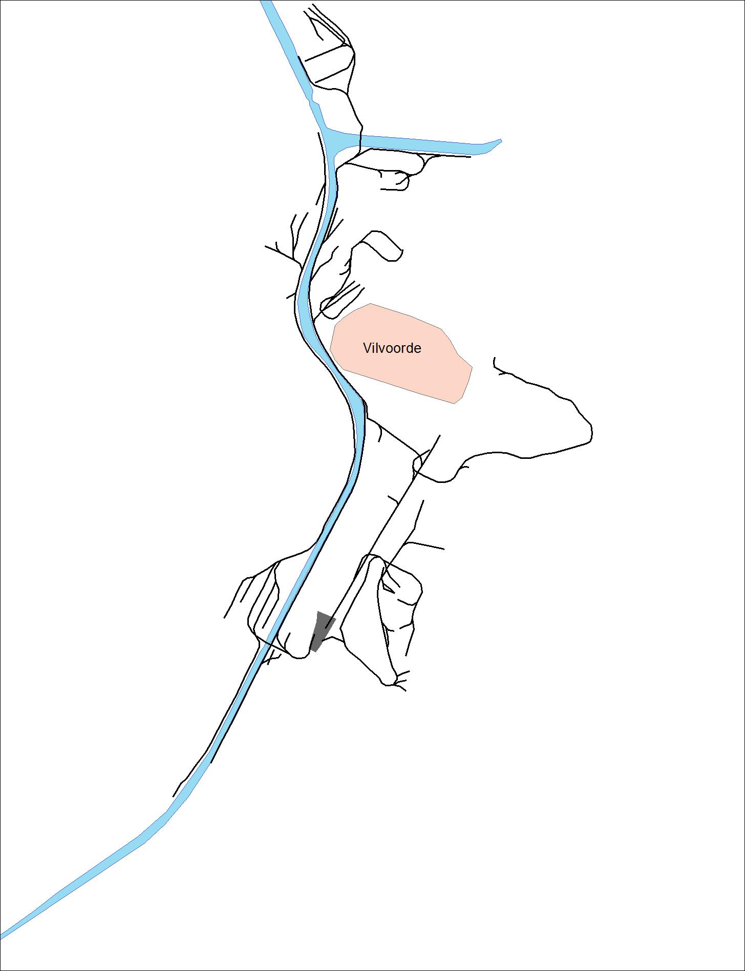
This image was acquired from
wikimedia. It was marked as Public Domain or CC0 and is free to use. To verify, go to the source and check the information there.
Looking for more info about this image?
Try a Google Reverse Image Search for it.
Try a Google Reverse Image Search for it.
Keywords from Image Description:
CFI . nl Netwerk van de Chemin de Fer Industriel rond Vilvoorde in de jaren Gebaseerd op de topografische kaarten van het MGI De opname op terrein door het MGI gebeurd in de periode voor het deel op kaartblad en in de periode voor het deel op kaartblad own WormkeGrutman other versions cczero Rail transport maps of Belgium Vilvoorde