Related Images


Download:
| Tiny | 166x128 | View | Download |
| Small | 333x256 | View | Download |
| Medium | 667x512 | View | Download |
| Large | 1335x1024 | View | Download |
| Original | 4125x3164 | View | Download |
This image was acquired from
wikimedia. It was marked as Public Domain or CC0 and is free to use. To verify, go to the source and check the information there.
Looking for more info about this image?
Try a Google Reverse Image Search for it.
Try a Google Reverse Image Search for it.
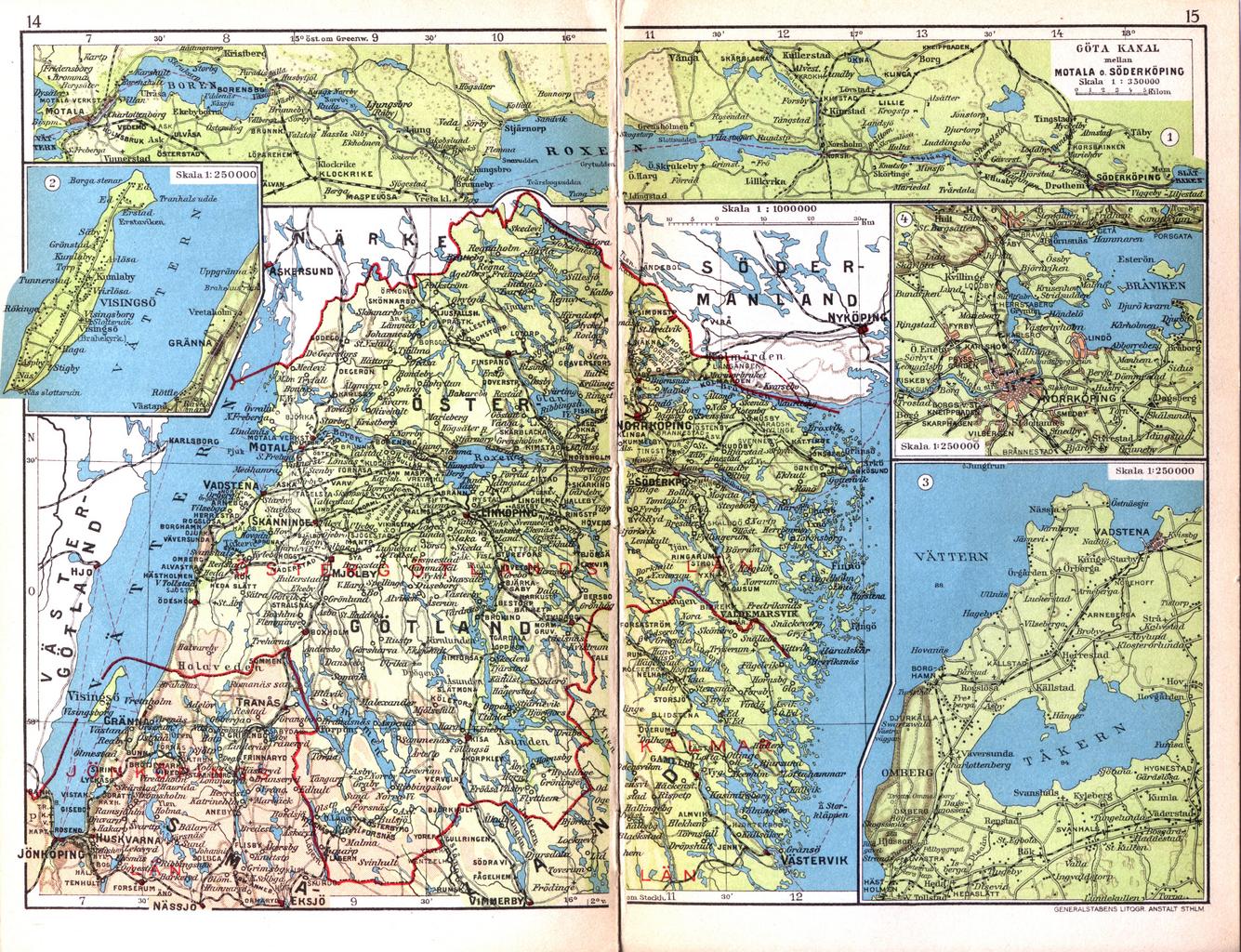
Keywords from Image Description:
Cohrs atlas ver Sverige stergtland. en Map of the province stergtland in Sweden sv Karta ver stergtland org html Cohrs atlas ver Sverige as scanned in dpi for Project Runeberg Cartographer Edvard Cohrs Scanned by LA PDold Derived from this map are Cohrs Tkern and Cohrs Visings Maps from Cohrs atlas ver Sverige